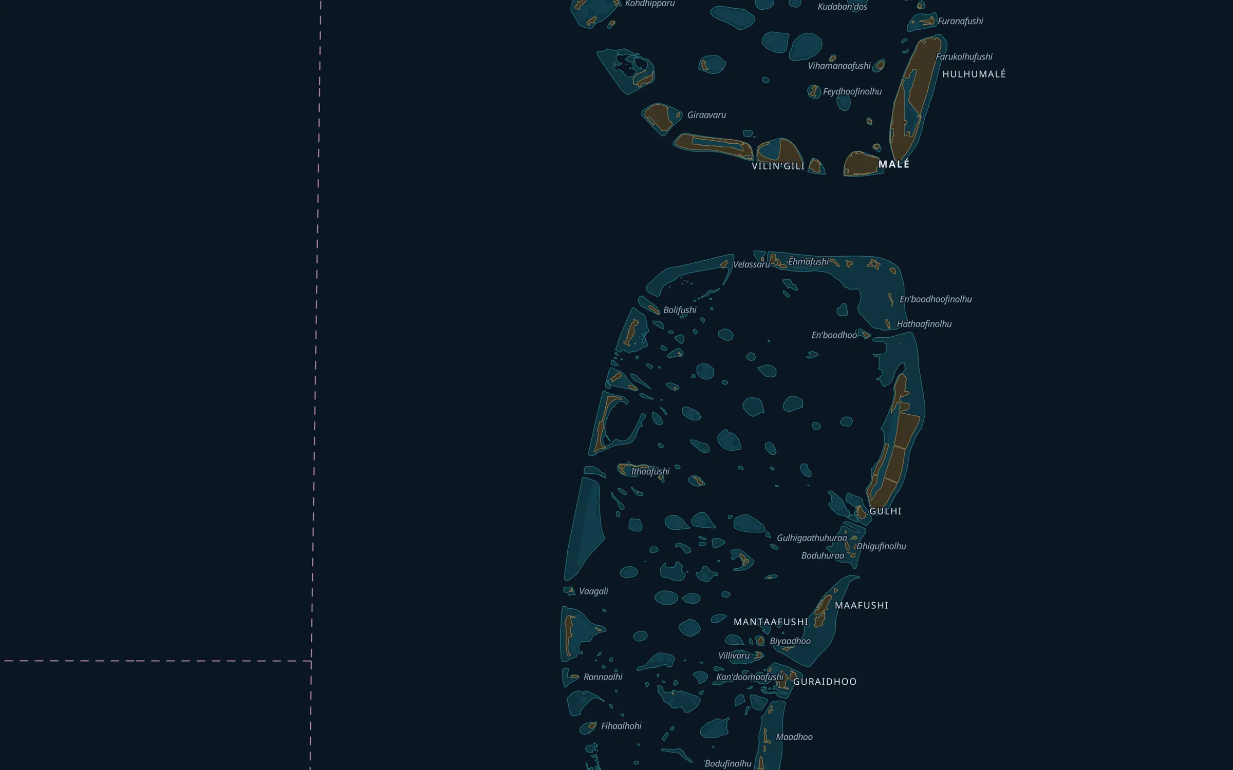









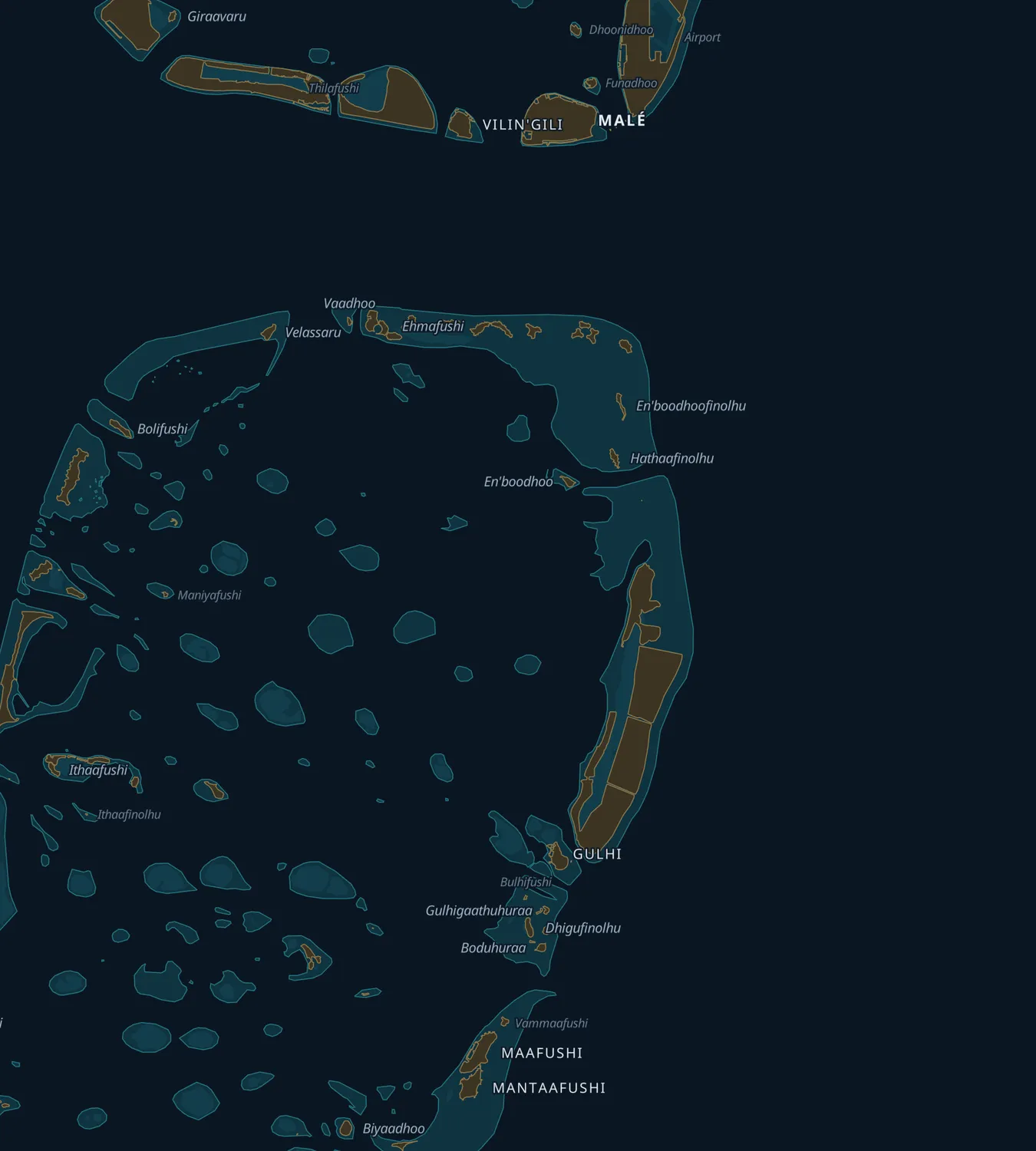
Dhuveli Midnight, our own chart of the Maldives: Malé, Hulhumalé and Villimalé down to Gulhi, Maafushi and Guraidhoo, with the reefs between them
Live GPS fleet tracking · Maldives

Your fleet, live on the map.

Dhuveli follows every boat you run: where it is now, every trip it makes, and when it will arrive. Schedules, crew, fuel and documents live alongside, and the alerts reach your team on Telegram. Built in Maafushi for operators across the Maldives.

42 millionGPS positions on file
343,226nautical miles sailed
53,491trips logged

Chart: Dhuveli Midnight · MLSA, © OpenStreetMap contributors. An example vessel, on the lane boats really take.

Operators on Dhuveli

  • Arena Hotels
  • iCom Tours
  • Shadow Palm
  • Maafushi Tours
  • Seadrop Tours
  • Seamonkey Maldives
  • Maldives Fellas
  • Kandu Trips
  • Triton Hotels & Tours
The live map

Every boat, every ten seconds, on a chart made for these waters.

Where each vessel is, how fast it is going and where it is heading, on our own chart of the Maldives or on satellite imagery, with the wind, the sea and the tide beside it. Send any boat's live map to a guest or an agent: it opens on any phone, with no app and no login.

  • Position, speed, heading and power for every boat, as often as every ten seconds
  • Private share links per vessel, with an expiry if you want one
  • An arrival time when a boat is under way, learnt from its own past voyages
  • Embed the live map on your own website, locked to your domain

Screenshots of the app as it runs today.

dhuveli.com
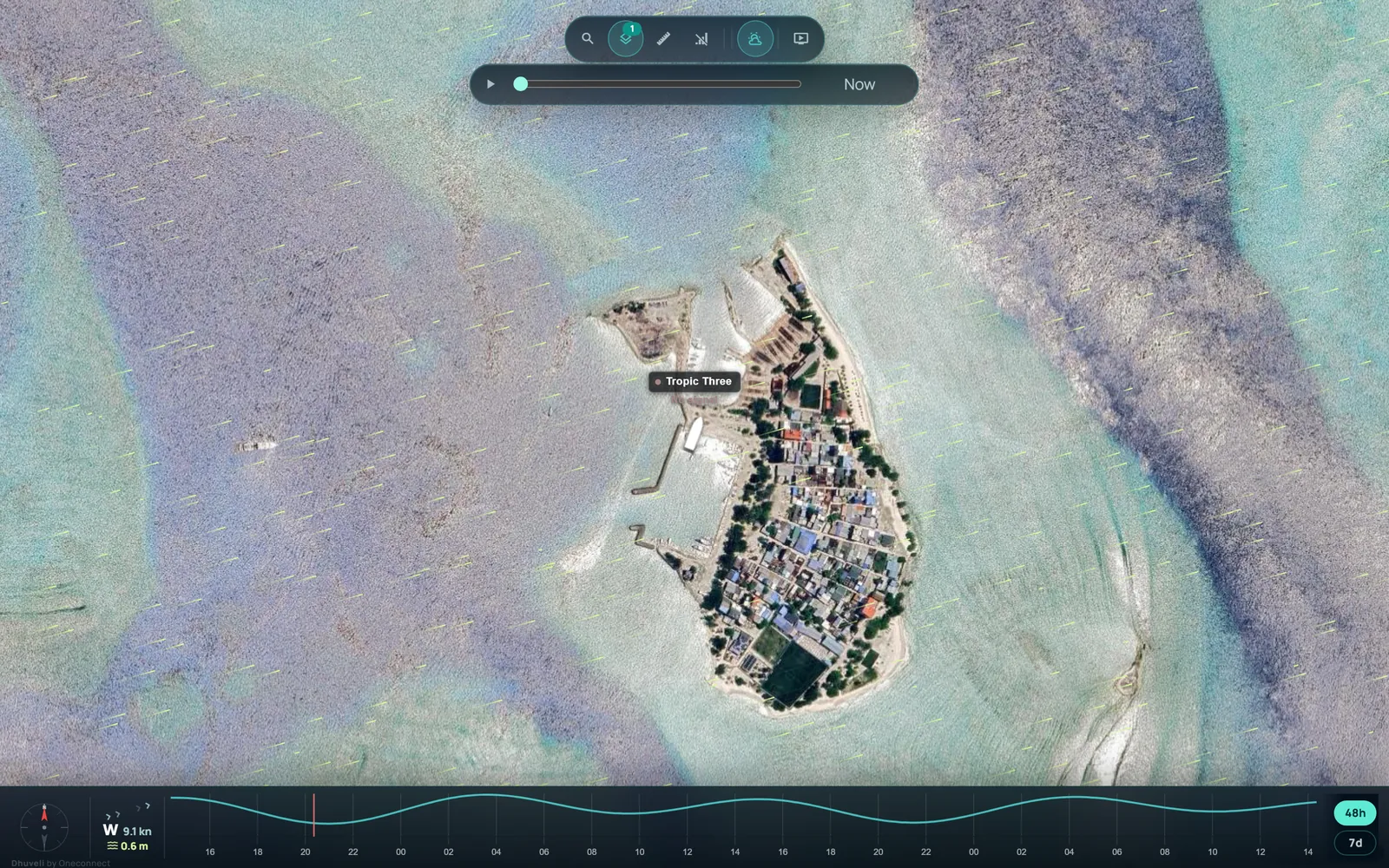
The Dhuveli live map on satellite imagery: a vessel at Gulhi's jetty, the wind streaming over the lagoon, and the tide for the next two days along the bottom
Live · every ten seconds
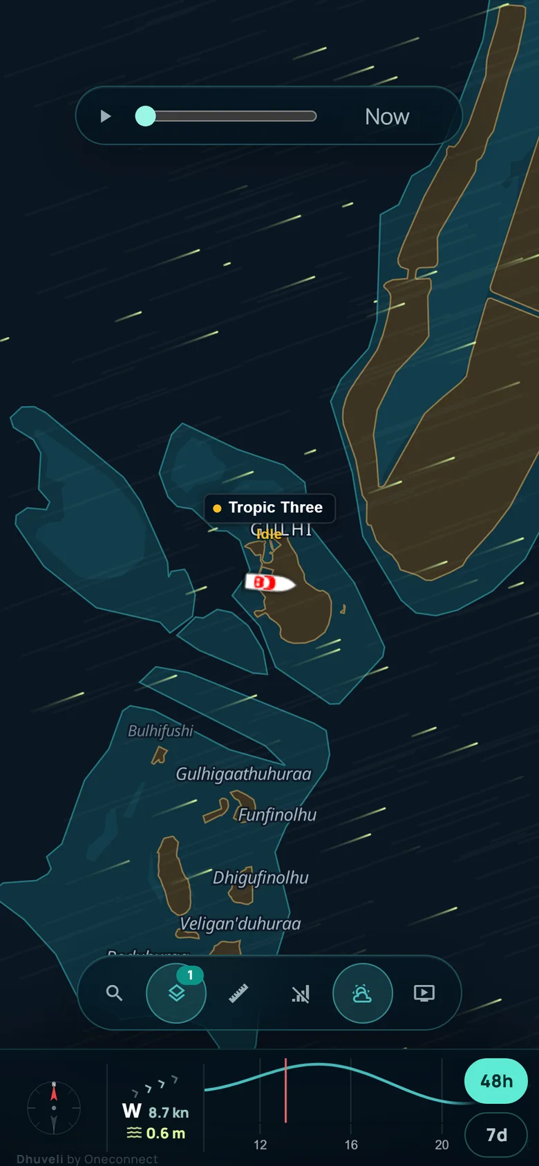
A shared live map on a phone: one vessel on the chart with the weather and tide strip below
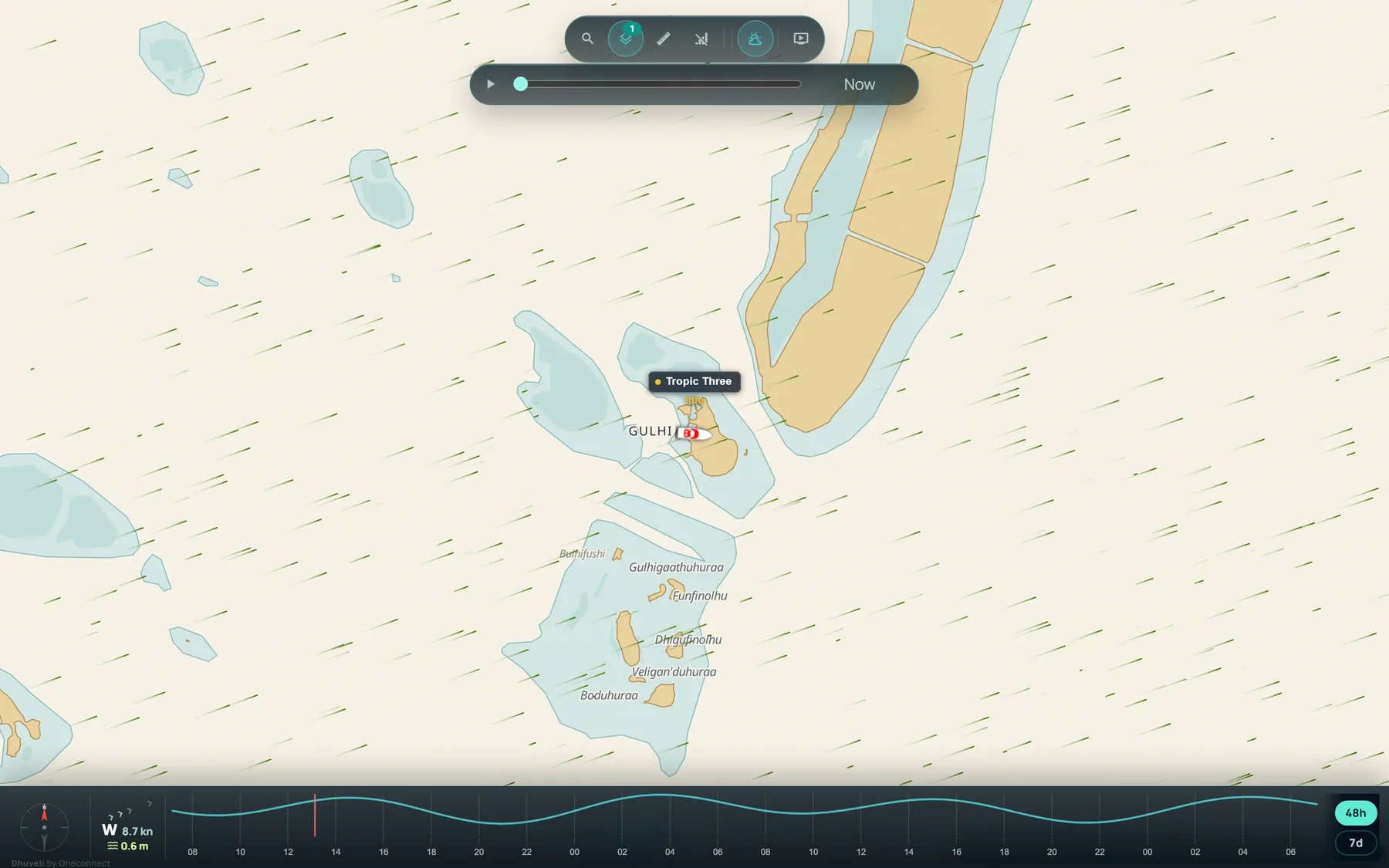
The live map on Dhuveli Daylight, our own chart: islands, reefs and lagoons around Gulhi with a vessel on it and the wind drawn over the sea
Dhuveli Daylight & Midnight

Our own chart of the Maldives.

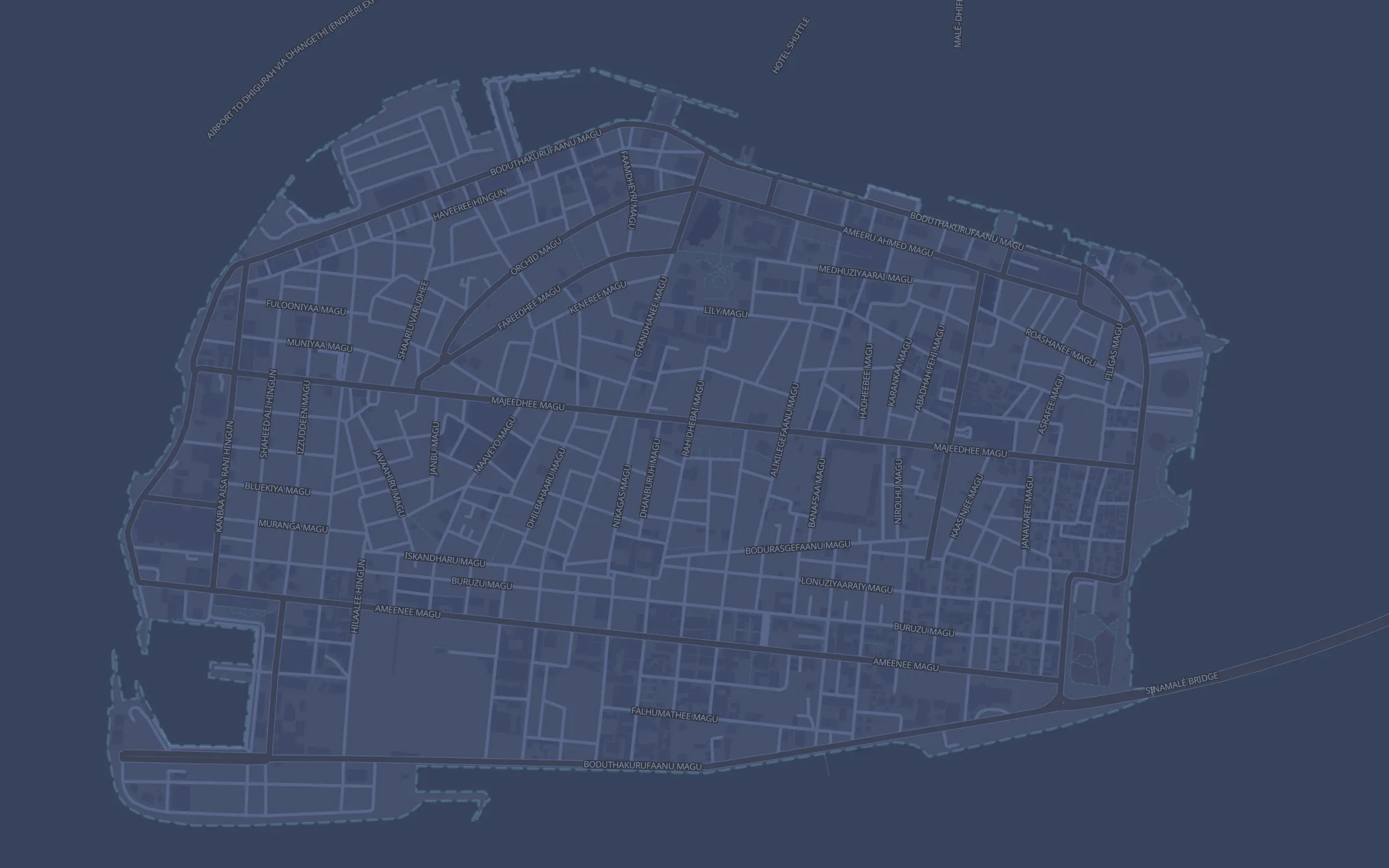
Drawn from the survey authority's islands, reefs and lagoons and kept current with new harbours and reclaimed land. Dhuveli Daylight for the day, Dhuveli Midnight for the wheelhouse at night, and Google or Mapbox satellite imagery one click away.

  • Position, speed, heading and power for every boat, as often as every ten seconds
  • Harbours, lights, marks, reefs and lagoons as layers you can switch on
  • Route history and heatmaps for any vessel, any day
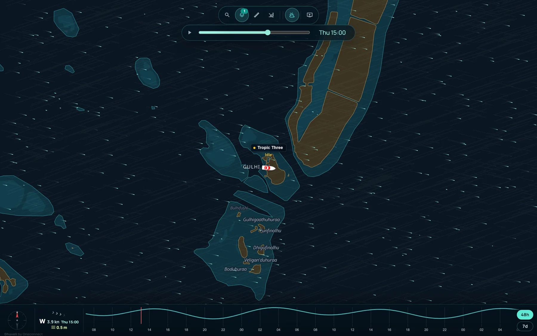
The wind layer with its time slider set to Thursday 15:00: the forecast wind moving over the map, and the weather strip showing the wind and sea for that hour
Wind, two days ahead

See tomorrow's wind before you sail.

The forecast wind moves over the map as particles: direction as motion, strength as pace and colour. Drag the slider up to 48 hours ahead and the strip below shows the wind and sea for that hour, wherever the map is looking.

  • Wind, gusts, sea state and swell for any point in the country
  • Seven days of tide for every island, computed on the spot
  • The same readings in every vessel's popup, at the boat rather than at the map centre
Dhuveli Midnight from Malé down to Maafushi, with the lane boats take between them past Gulhi
Left 08:12Maafushi
Arrived 09:04Malé
One voyage

From the jetty to your group chat.

Launch 3 leaves Maafushi. Dhuveli sees it go, works out where it is heading and when it will get there, and logs the trip the moment it ties up in Malé. Your team hears each step in Telegram.

Fleet alertsDhuveli bot · your team
08:12Launch 3 — ▶️ Underway from Maafushi
08:54Launch 3 — 🕒 Arriving Malé in about 10 min · 09:04
09:04Launch 3 — 🏁 Arrived Malé 09:04 · from Maafushi 08:12 · 14.9 nm · 52 min · top 24.1 kn
Launch 3 → Malé09:04
Left Maafushi 08:12Arrival learnt from its own past voyages

An example voyage, on the lane boats really take.

Everything connected

The movement and the paperwork, in one place.

What the office sees, as the app shows it: every trip as it is logged and the papers about to lapse, beside the schedules, the fuel and the checklists. The boats below are examples; the layouts are the real ones.

A trip log that keeps itself

Every voyage recorded as it happens: departure, stops, distance, speed and captain. Replay any trip on the map; export to CSV or PDF.

VesselTripLeftTookDistanceMax
Launch 3Maafushi → Malé08:1252 min27.4 km24.1 kn
Sea BreezeGulhi → Maafushi09:3019 min6.8 km18.0 kn
Dhoni 2Maafushi → sandbank → Maafushi10:052 h 4014.2 km9.6 kn

Documents & expiry

Every permit, licence and certificate in one place, with a reminder before anything lapses.

  • Seaworthiness certificate · Launch 312 days
  • Captain's licence · A. Rasheed48 days
  • Registration · Dhoni 27 months

Schedules & crew

Trips, captains, crew and agents on one daily board, with passenger manifests, and each departure checked against the trip that actually ran.

Fuel

Refuelling logged per vessel, consumption compared across trips and captains, and the cost of a route you can finally see.

Maintenance & safety

Reusable checklists on a schedule or on demand, with open issues and the history kept against each boat.

See all features  
Changelog · October 2026

New in Dhuveli.

Dhuveli changes most weeks. The latest, newest first; the full record, back to the beginning, is on the changelog.

View full changelog  
  1. Which way the boat is

    Your own position on the map, as a blue dot with a beam that turns with your phone, and how far the boat is from you and which way. A link to one boat now invites the guest to show theirs, and keeps the distance in view.

  2. Vehicle tracking

    Cars, vans, pickups, buses and bikes on a street map of Malé, Hulhumalé or Maafushi, with every trip named by the street and the landmark and speeds in km/h. See vehicle tracking.

  3. Satellite by default

    The map opens on Google satellite imagery again. Dhuveli Daylight and Dhuveli Midnight are one click away, and a map you have chosen stays chosen.

  4. Wind, two days ahead

    A slider under the map controls scrubs the forecast up to 48 hours ahead in three-hour steps, and the weather strip follows the hour you pick.

  5. Wind on the map

    The forecast wind as moving particles over the map: direction as motion, strength as pace and colour. On the live map and on shared links alike.

Free & open · no sign-up

The Maldives Atlas, built from the same data our maps run on.

Every island, harbour, jetty, dive site, wreck, FAD, ice plant, navigation light and protected area in the country — with coordinates, Dhivehi names and the places around each one. Plus tide times for any island and live wind and sea by atoll. We built it because we needed it, and there is no reason to keep it to ourselves.

1,134Islands
21Atolls
873Places
2,515Reefs

Sources credited on every page: the Maldives Land and Survey Authority, the Fisheries Information System, OpenStreetMap contributors and the EOT20 tide model. For planning, not for navigation.

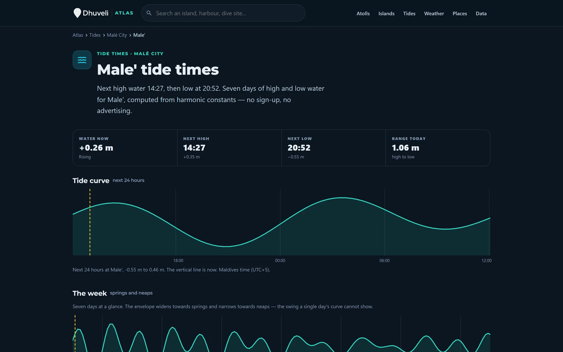
The Atlas's tide page for Malé: next high and low water, the tide curve for the next 24 hours and the week's springs and neaps
Tide at Male' Today
High 01:49 +0.52 m
Low 07:50 −0.28 m
High 13:27 +0.35 m
Low 19:41 −0.53 m

Computed here, now, from harmonic constants — the same figures the atlas serves for all 1,134 islands. Maldives time, metres about mean sea level.

How it fits together

From a fix every ten seconds to the message in your group.

  1. Track

    The tracker reports position, speed, heading and power every ten seconds over the mobile network.

    fix · 3.9412, 73.4891 · 18.0 kn
  2. Understand

    Fixes become trips, stops, distances and speeds; a boat under way gets a destination and an arrival time.

    trip · Maafushi → Malé · 27 km
  3. Coordinate

    The day's schedule, crew, documents and share links sit beside the live map, so the office works from one screen.

    09:00 · Launch 3 · Capt. Rasheed
  4. Respond

    The people who need to know hear in Telegram, or your own systems do by webhook, the moment it matters.

    Telegram · arrived Malé 09:04
Pricing

Plans for single vessels and growing fleets.

Choose the level of history, update speed, sharing, and operational tooling your team needs.

Dhuveli Basic

Essential vessel tracking and alerts.

Rf1,800/ year
  • 30-second location updates
  • Telegram alerts
  • ETA and limited sharing
  • Up to 10 geofences
Get started
Most popular

Dhuveli Plus

Faster updates, history and stronger reporting.

Rf2,500/ year
  • 20-second location updates
  • Unlimited private sharing
  • Speed analysis & reports
  • Data SIM included
Get started

Dhuveli Pro

Full operational platform for fleet teams.

Rf3,999/ year
  • 10-second location updates
  • 1 year history & analytics
  • Schedules, crew, fuel & docs
  • Premium support
Get started

Prices in Maldivian Rufiyaa (Rf), billed annually. GPS devices & installation quoted separately.

Compare all plans  
Devices

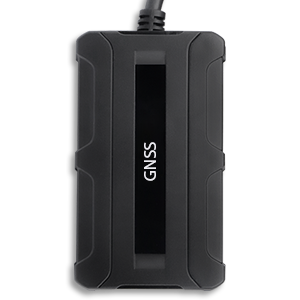
Rugged trackers for marine conditions.

Dhuveli supports thousands of tracker models and can supply practical hardware options for boats, tenders, and portable use cases.

Best value Compact IP67 GPS tracker

Compact IP67 Tracker

Cost-effective tracker with internal GPS/GSM antennas and optional Bluetooth connectivity. Ideal for small tenders and dinghies.

Rf 1,700
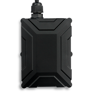
IP67 GPS tracker with accessories

Accessory-ready IP67 Tracker

Supports 1-Wire accessories including temperature sensors and fuel level probes. Best for larger working vessels.

Rf 3,700
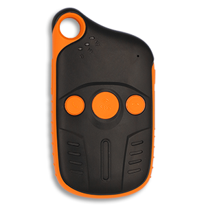
Portable GNSS tracker

Portable GNSS Tracker

Long-standby portable tracker with a rugged, water-resistant design. Perfect for crew safety and portable operations.

Rf 4,700
Devices & installation  
For developers

A token-secured REST API and an embeddable live map, for booking systems, resort dashboards and your own apps.

Read the API docs  
FAQ

Common questions answered.

Over 2,000 models. Dhuveli works with major brands like Teltonika, Queclink, Concox and Coban — if your tracker reports standard GPS over GPRS, it'll almost certainly work. Not sure about yours? Send us the model and we'll confirm.
As fast as every 10 seconds. Update speed depends on your plan and tracker — 30 seconds on Basic, 20 on Plus and 10 on Pro, with the device configured to match.
Yes. Generate a secure public link for any vessel and anyone with it can follow the live map — no login needed. Links can be permanent or set to expire automatically, and you choose which vessels appear.
Up to a full year. Basic keeps 30 days, Plus keeps 6 months and Pro keeps 12 months of history, with downloadable reports.
Yes — we supply, fit and configure marine-ready trackers across the Maldives, and provide data SIMs suited to life at sea. Get in touch and we'll arrange installation for your fleet.
Yes. Embed any share link's live map in your own website with an iframe — locked to the domains you whitelist — and developers can pull live positions, tracks and events from our API.
Your data is yours. Access is scoped to your company and your team's roles, public links never expose internal device IDs, and you decide exactly what's shared and for how long.
By design. Dhuveli is a fast, fully responsive web app, so it works instantly on any phone, tablet or desktop — nothing to install or keep updated, and the same live link opens everywhere. Add it to your home screen and it works just like an app.
Get in touch

We're here to help your fleet get connected.

Whether you need a demo, a quote, or help with installation — reach out and we'll respond within one business day.

Office
Maafushi, Kaafu Atoll
Republic of Maldives
Support hours
Sun – Thu, 8:00 AM – 6:00 PM MVT

Send us a message

Replies within a business day

Opens WhatsApp with your message ready to send. Prefer email? info@dhuveli.com

Put your fleet on the map.

Live tracking, trips, crew, fuel and documents in one workspace, from one public vessel link to the whole fleet's office.